Additional information related to the photos presented in the ground-floor hall of the Ecotourism Visitor Center established in the area of the Fürdőkert Youth Leisure Center, along with the history and presentation of the individual mounds.
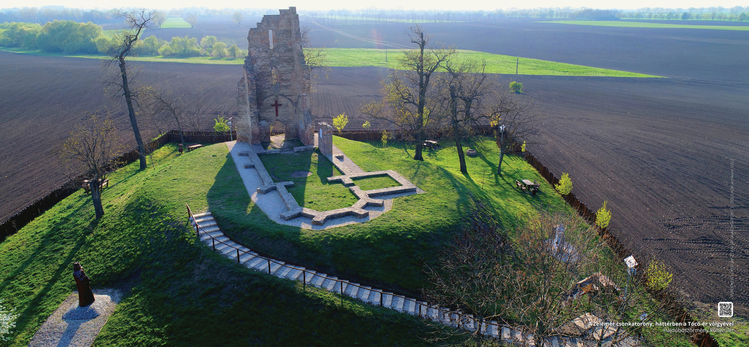
Truncated tower of Zelemér
The cultural history monument and popular excursion destination, which is easily accessible by rail and road, rises above the landscape across from the Zelemér railway station of the Debrecen-Tiszalök railway line. The ruins of the church on the mound have been known since the early Árpád period, then preserve the memory of the village of Zelemér, which was destroyed during the Tatar invasion and subsequently repopulated. The ruins of the late Gothic, single-nave church, built in the 16th century, have been a monument since 1907, after the De Pauli forest estate, together with the 600 square feet of land around it, donated it to the town. The ruins were excavated between 1938 and 1941 by the museum’s founders Antal Csiha and archaeologist János Sőregi, and its foundation walls were made presentable by social work in 1972.
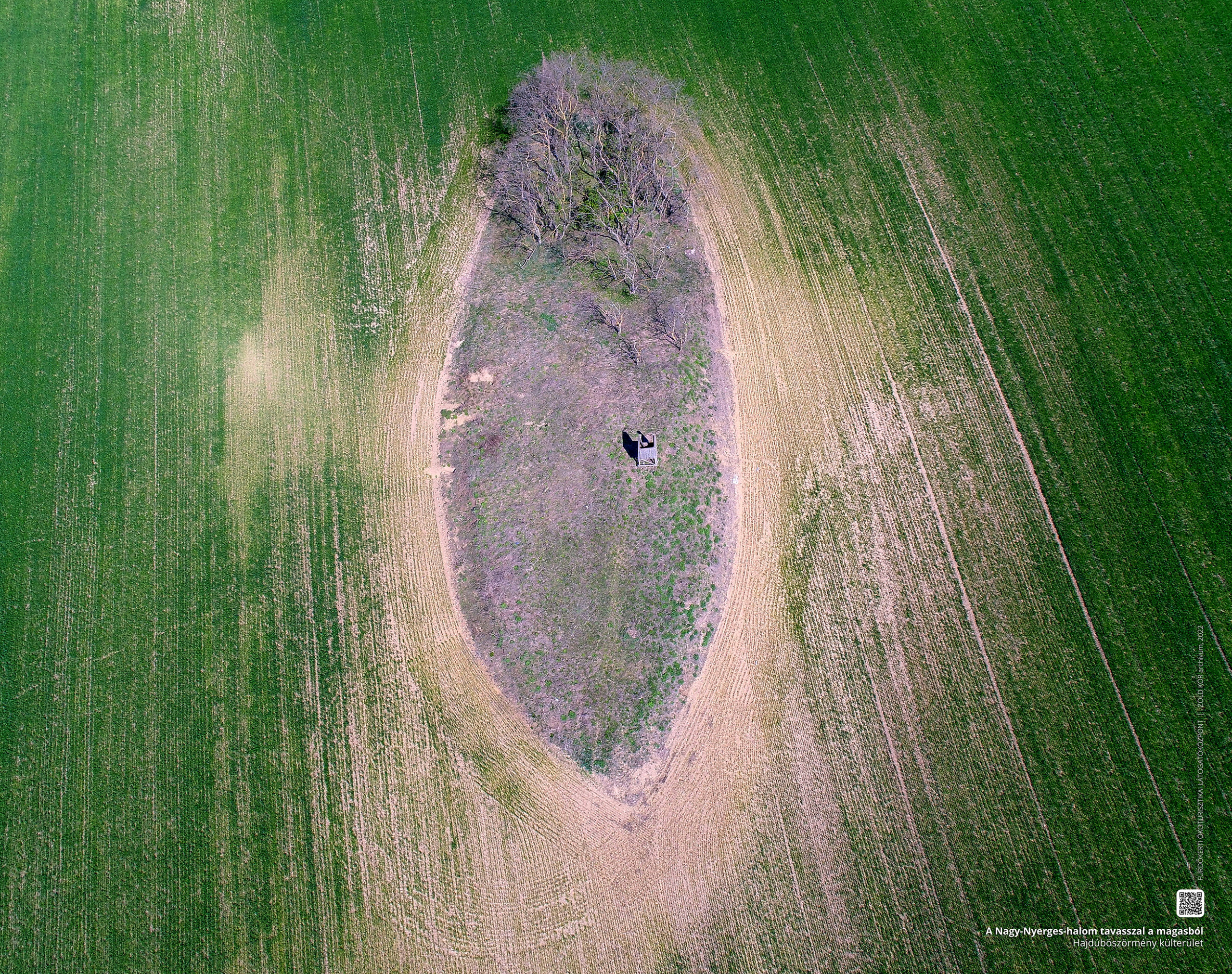
Great Saddle Mound
The 122-meter-high kurgan, wedged in the agricultural environment next to the Great Saddle Meadow to the north of the city, belonged administratively to Hajdúhadház until 1979. The origin of its name is associated with the destruction of the village of Vid, which was once inhabited by Rács. According to the legend about this, the Rács of Vid hatched a plan to invade the Hajdús. Of which a beggar-woman brought news to the Hajdús of Böszörmény, Hadház, and Nánás, who, on learning of it, banded together and saddled at this and the nearby Little Saddle Mound to overrun and toss the Rács to the sword. The protection of the mound is justified from a conservation and archaeological point of view.
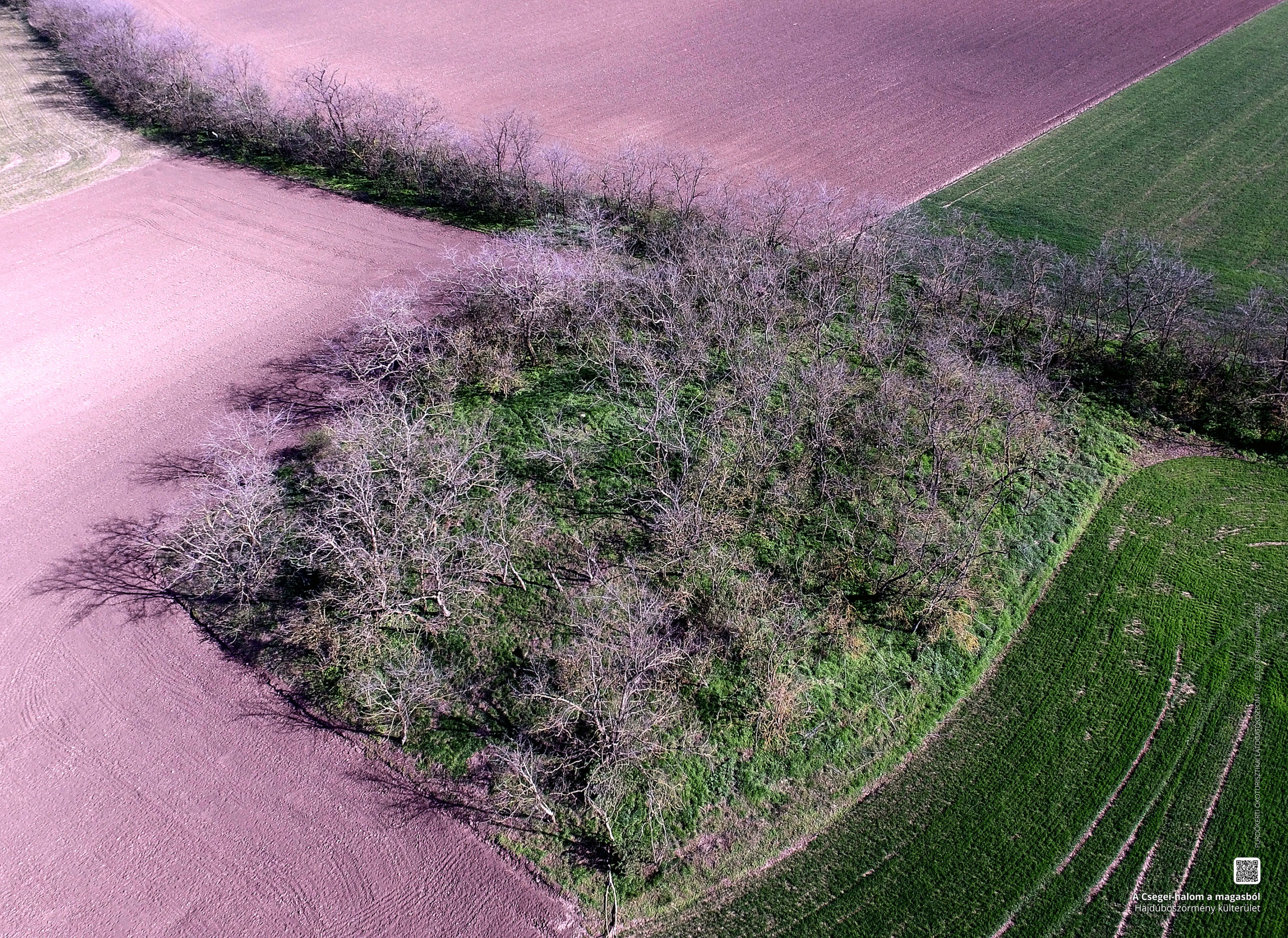
Mound of Csege
This kurgan, which preserves its ancient character in its form, is located on the border line between Hajdúböszörmény and Debrecen, a few hundred meters from Upper Józsa. With an altitude of 167 meters above sea level, it is one of the highest elevations of Hajdúhát. Although archaeologically unexplored, in 1858 a find known as the “Böszörmény treasure” was found in its immediate vicinity. The find, consisting of Bronze Age weapons, was then placed in the collection of the Reformed College of Debrecen, and in the Hajdúság Museum in Böszörmény only photographs of the artefacts can be found (today the find is in Budapest). Péter H. Fekete, a local historian, considers the name of the mound to be a reference to the name of a long-dead village, which preserves the name Csege- or Cseke-telke.
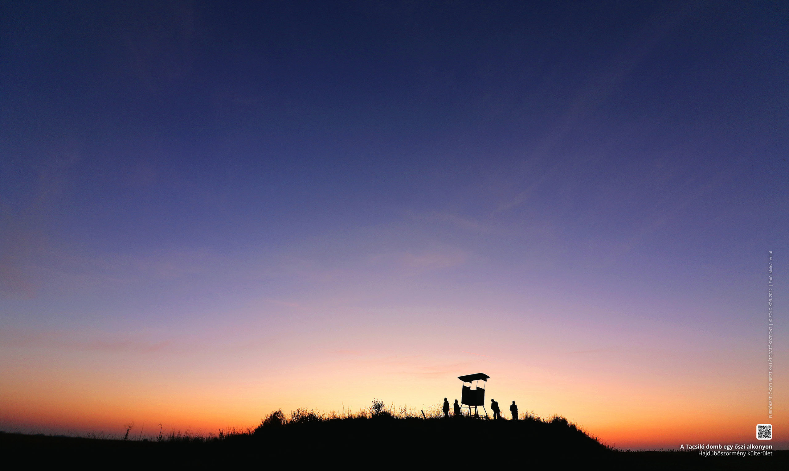
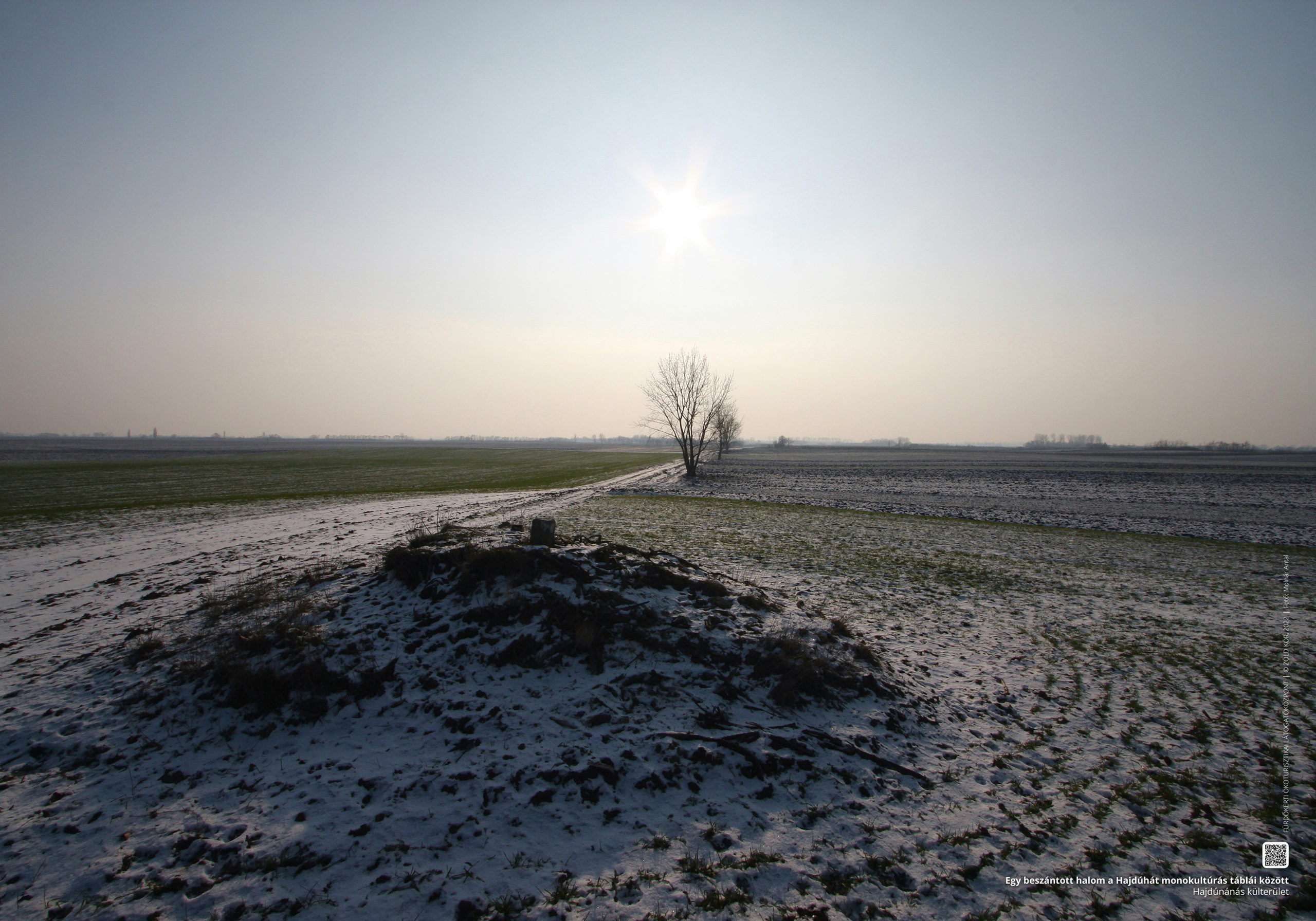
Tacsilló Hill
Along the borderline between the towns of Hajdúböszörmény and Balmazújváros, at the foot of the reed bed of the Virágoskút fishponds, the border area beyond the Eastern Main Canal is clearly visible. The laponyag has a height of 98 metres above sea level and a relative height of only 2 metres. Although the origin of its name is unknown – and military censuses regularly mention it without a name – we can find it in the city archives as early as 1748 as “Tatsilló’s mound“. Although the mound body contains some elements of loess grassland, its botanical values are degraded, partly due to the extensive fox dens on its sides.
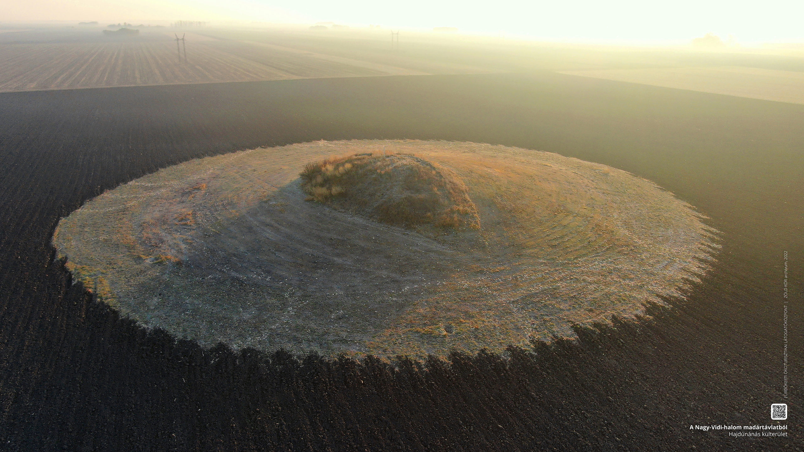
Great Mound of Vid
On the outskirts of Hajdúnánás, according to some assumptions, the mound body of kurgan, located near the former village of Vid, can be considered intact and botanically valuable, the current owner of which has restored the character of the former ancient turf in an exemplary manner, surrounded by the surrounding monoculture cultural desert. Archaeologically excavated, the excavations led by archaeologist Dr. György Módi confirmed that the site was inhabited from the New Stone Age onwards. New Stone Age, Copper and Bronze Age finds have been unearthed, as well as Sarmatian and Arpadian values have been found as excellent examples of the stacking of cultures.
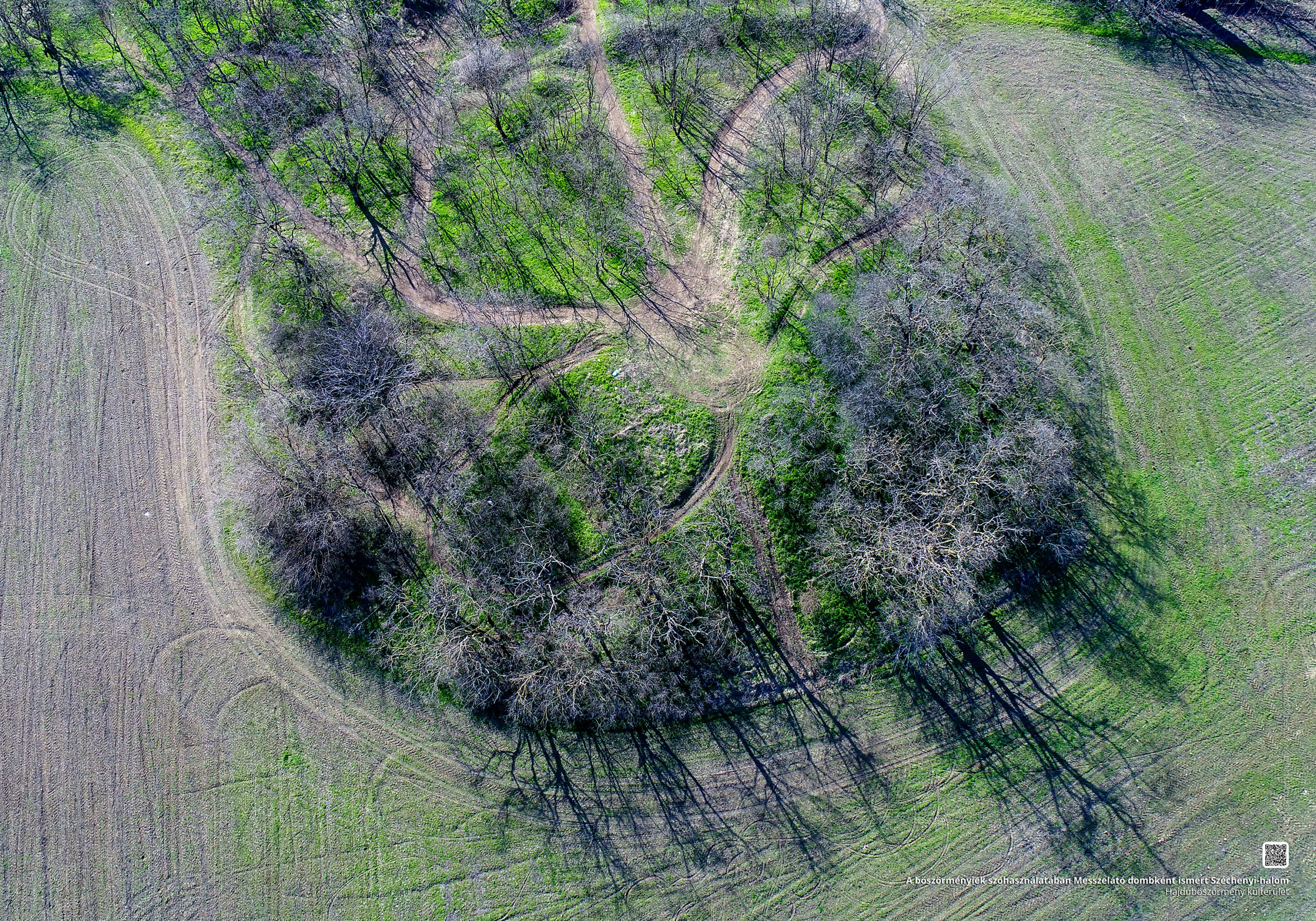
Széchenyi Mound
The hill, colloquially known as Messzelátó Hill, is perhaps one of the best known hills on the outskirts of the town, which was reconstructed by the Municipality of Hajdúböszörmény in 2021, and a rest area was built at its base.
In the past, the Messzelátó csárda stood next to it, today a poultry farm. Péter H. Fekete writes about it in his work entitled The Repository of Place Names of Hajdúböszörmény, published in 1959:
“In the southern part of the border, next to the Debrecen highway, after the name of Nagy Strázsa Mound, this name was not worn until 1861, when the city named it Széchenyi Mound out of respect for Count István Széchenyi and to commemorate his memory.” From the minutes of the city archives of 1861, we can also learn that 13 cubic hectares of land were left out of the mound named “Széchenyi at Messzelátó”, in order to create a garden named Széchenyi.
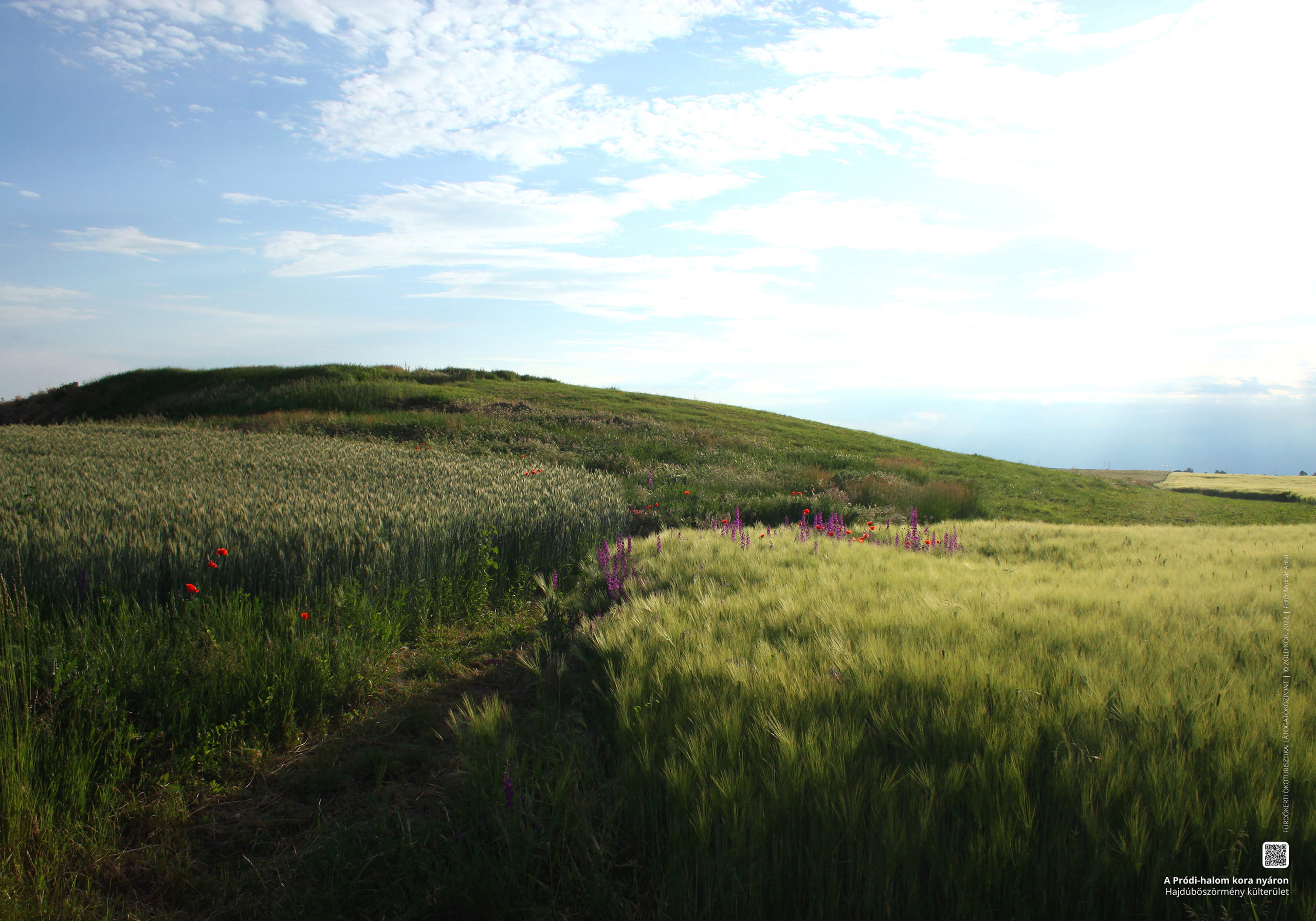
Mound of Pród
The former residential mound on the western border of the village of Pród, which belongs to Hajdúböszörmény, is an archaeologically excavated kurgan of modest natural value. In the summer of 1882, the finds recovered from the mound excavated by the archaeologists Flóris Rómer and József Hampel in Debrecen were transferred to the National Museum. After that, Ferenc Forgács, a shepherd from Hortobágy and a resident of Böszörmény, dug the ancestral settlement until Christmas after each harvest from 1925 to eight years, based on dream vision, in search of Attila’s grave. After his death, his son-in-law and sons also continued their search for treasure, during which, when breaking through the layers of culture, they found a whole series of artifacts and even, based on narratives, underground passages.